 NERC Data Catalogue Service
ESRI Shapefile
Type of resources
Available actions
Topics
Keywords
Contact for the resource
Provided by
Years
Formats
Representation types
Update frequencies
Scale
Resolution
-

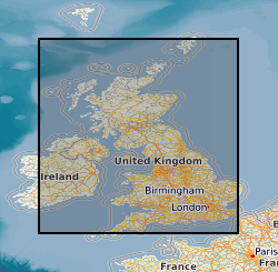
**This dataset has been superseded** The newGeoSure Insurance Product (newGIP) provides the potential insurance risk due to natural ground movement. It incorporates the combined effects of the 6 GeoSure hazards on (low-rise) buildings: landslides, shrink-swell clays, soluble rocks, running sands, compressible ground, and collapsible deposits. These hazards are evaluated using a series of processes including statistical analyses and expert elicitation techniques to create a derived product that can be used for insurance purposes such as identifying and estimating risk and susceptibility. The evaluated hazards are then linked to a postcode database - the Derived Postcode Database (DPD), which is updated biannually with new releases of Ordnance Survey Code-Point® data (current version used: 2023.1). The newGIP is provided for national coverage across Great Britain (not including the Isle of Man). This product is available in a range of GIS formats including Access (*.dbf), ArcGIS (*.shp) or MapInfo (*.tab) on request. The newGIP is produced for use at 1:50 000 scale providing 50 m ground resolution.
-

Radon is a natural radioactive gas, which enters buildings from the ground. The joint UK Health Security Agency (UKHSA) (formerly Public Health England (PHE) ) - British Geological Survey (BGS) digital Indicative Atlas of radon in Great Britain presents an overview of the results of detailed mapping of radon potential, defined as the estimated percentage of homes in an area above the radon Action Level. Exposure to high concentrations increases the risk of lung cancer. UKHSA (formerly PHE) recommends that radon levels should be reduced in homes where the annual average is at or above 200 becquerels per cubic metre (200 Bq m-3). This is termed the Action Level. UK Health Security Agency defines radon Affected Areas as those with 1% chance or more of a house having a radon concentration at or above the Action Level of 200 Bq m-3. The Indicative Atlas of radon in Great Britain presents a simplified version of the radon potential for Great Britain with each 1-km grid square being classed according to the highest radon potential found within it, so is indicative rather than definitive. The joint UKHSA-BGS digital radon potential for Great Britain provides the current definitive map of radon Affected Areas in Great Britain.
-
Grounding line locations (GLL) data for the Evans and Rutford Glaciers in Antarctica, produced by the ESA Antarctic Ice Sheet Climate Change Initiative (CCI) project. The grounding lines have been derived from satellite observations from the ERS-1/2 and Copernicus Sentinel-1 instruments, acquired between 1995 and 2016.
-
Grounding line locations (GLL) data for the Lambert and West Ice Shelf Glaciers in Antarctica, produced by the ESA Antarctic Ice Sheet Climate Change Initiative (CCI) project. The grounding lines have been derived from satellite observations from the ERS-1/2 and Copernicus Sentinel-1 instruments, acquired between 1996 and 2016.
-

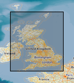
**This dataset has been superseded** The newGeoSure Insurance Product (newGIP) provides the potential insurance risk due to natural ground movement. It incorporates the combined effects of the 6 GeoSure hazards on (low-rise) buildings: landslides, shrink-swell clays, soluble rocks, running sands, compressible ground and collapsible deposits. These hazards are evaluated using a series of processes including statistical analyses and expert elicitation techniques to create a derived product that can be used for insurance purposes such as identifying and estimating risk and susceptibility. The evaluated hazards are then linked to a postcode database - the Derived Postcode Database (DPD), which is updated biannually with new releases of Ordnance Survey Code-Point® data (current version used: 2022.3). The newGIP is provided for national coverage across Great Britain (not including the Isle of Man). This product is available in a range of GIS formats including Access (*.dbf), ArcGIS (*.shp) or MapInfo (*.tab) on request. The newGIP is produced for use at 1:50 000 scale providing 50 m ground resolution.
-
Radon is a natural radioactive gas, which enters buildings from the ground. The joint UK Health Security Agency (UKHSA) (formerly Public Health England (PHE)) - British Geological Survey (BGS) digital dataset Radon Potential for Great Britain provides the current definitive map of radon Affected Areas in Great Britain. Exposure to high concentrations increases the risk of lung cancer. UK Health Security Agency (formerly PHE) recommends that radon levels should be reduced in homes where the annual average is at or above 200 becquerels per cubic metre (200 Bq m-3). This is termed the Action Level. The UKHSA defines radon Affected Areas as those with 1% chance or more of a house having a radon concentration at or above the Action Level of 200 Bq m-3. The dataset allows an estimate to be made of the probability that an individual property is at or above the Action Level for radon. This information provides an answer to one of the standard legal enquiries on house purchase in England and Wales, known as CON29 standard Enquiry of Local Authority; 3.13 Radon Gas: Location of the Property in a Radon Affected Area. Radon Potential for Great Britain also provides information on the level of protection required for new buildings as described in the latest Building Research Establishment guidance on radon protective measures for new buildings (Radon: guidance on protective measures for new dwellings; BR 211, 2015 in Scotland, England, Wales and Northern Ireland). This radon potential hazard information for Great Britain is based on UKHSA indoor radon measurements and BGS digital geology information. This product was derived from BGS Geology 50k (formerly known as DigMap50k) version 8 and UKHSA in-house radon measurement data. The indoor radon data is used with the agreement of the UKHSA. Confidentiality of measurement locations is maintained through data management practices. Access to the data is under licence.
-
The BGS GeoCoast Dataset is a Geographic Information System (GIS)-based analysis for indicating multi-hazards and interdependencies within the coastal zone of Great Britain (not including Orkney and Shetland). GeoCoast represents the natural geological coastline (around the mainland of Great Britain) as if no coastal defences or made ground are present. This will be of particular value in areas where coastal defences are no longer maintained. GeoCoast will offer anyone with assets, or an interest in the coastline around Great Britain, access to easy-to-use datasets linked to geohazard data. This will allow users to interpret potential interdependencies in terms of erosion, flooding, habitat and other vulnerabilities. These datasets are divided into two data packages: Premium and Open datasets, which include the following information: The data is delivered in GIS ESRI point, polyline and polygon format (other formats available on request).
-
Grounding line locations (GLL) data for the Slessor Glacier in Antarctica, produced by the ESA Antarctic Ice Sheet Climate Change Initiative (CCI) project. The grounding lines have been derived from satellite observations from the ERS-1/2, TerraSAR-X and Copernicus Sentinel-1 platforms, acquired between 1995 and 2016.
-
Grounding line locations (GLL) data for the Getz Glacier in Antarctica, produced by the ESA Antarctic Ice Sheet Climate Change Initiative (CCI) project. The grounding lines have been derived from satellite observations from the ERS-1/2 instruments, acquired in the period from 1996-2017.
-
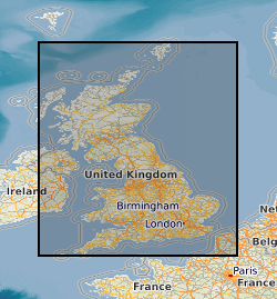
The GeoSure data sets and reports from the British Geological Survey provide information about potential ground movement or subsidence in a helpful and user-friendly format. The reports can help inform planning decisions and indicate causes of subsidence. The methodology is based on BGS DiGMap (Digital Map) and expert knowledge of the behaviour of the formations so defined. This dataset provides an assessment of the potential for a geological deposit to shrink and swell. Many soils contain clay minerals that absorb water when wet (making them swell), and lose water as they dry (making them shrink). This shrink-swell behaviour is controlled by the type and amount of clay in the soil, and by seasonal changes in the soil moisture content (related to rainfall and local drainage). The rock formations most susceptible to shrink-swell behaviour are found mainly in the south-east of Britain. Clay rocks elsewhere in the country are older and have been hardened by burial deep in the earth and are less able to absorb water. The BGS has carried out detailed geotechnical and mineralogical investigations into rock types known to shrink, and are modelling their properties across the near surface. This research underpins guidance contained in the national GeoSure dataset, and is the basis for our responses to local authorities, companies and members of the public who require specific information on the hazard in their areas. The BGS is undertaking a wide-ranging research programme to investigate this phenomenon by identifying those areas most at risk and developing sustainable management solutions. Complete Great Britain national coverage is available. The storage formats of the data are ESRI and MapInfo but other formats can be supplied.